
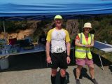
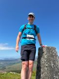
Drumgoff
- Description:
- Drumgoff
- County:
- Wicklow
- Date:
- Sunday 28th May, 2023
- Time:
- 11:00
- Climb (m):
- 650
- Distance (km):
- 14.50
- Event Difficulty:
- 8 (2,3,3) - Moderate Terrain, >500M ascent, >10Km
- Race Marking:
-
 -
Route not marked
-
Route not marked - GPS Allowed:
- No
- Leagues:
- Leinster Championship
- Route Description:
- Free Route between CPs, except for between Croaghanmoira and Fananerin which must be ran along the fence line and from CP5 back to nearby saddle and then down along fence to cross stream on way back to finish. Controls will mark each target Checkpoint.
- Getting There:
- Drumgoff Recreational Area car park is c. 3k south of Glenmalure in the Aughavanagh direction.
- Organisers Instructions:
- 2023 Race will be run in an anticlockwise direction to avoid a route direction repeat of the recent Aughavannagh Race
Start: Drumgoff Recreation area GR 094 889
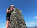
CP1 Slieve Maan North Top Spot Height (Brown Knob on EastWest maps) 546m - GR 084 887 Photo CP2 Slieve Maan Spot Height 547m - GR 082 880 - This is just to the east of ridge path - Ref: - Prizegiving Location:
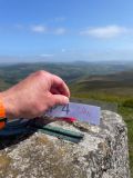
- Finish line at Drumgoff Rec area. At the finish competitors must show their control card for the 5 CPs punched.
Volunteers (Non-Running)
You need to have done 2 non-running volunteer roles in a calendar year to qualify for end of year prize
Volunteers (Running)
Check with race director if they have a need for people volunteering and running. Race directors need a minimum number of people available throughout the race to make the race work so non-running volunteers are preferable. While it can be helpful, volunteering in a volunteer and race capacity does not count towards qualifying for end of year prize
Carpool
| Driver Name | Location | Passing Through | Departure | Seats Available | Seats Accepted |
|---|---|---|---|---|---|
| David Power | Carrickmines, Dublin | 09:20:00 | 3 | 0 | |
| Louis Mullee | Cabinteely/Glenageary | Loughlinstown/Kilmac | 09:00:00 | 2 | 1 |