
Wicklow Round Challenge - Andre Van Barnevald
Authors
The Wicklow Round
26 October, 2020 - Andre Van Barneveld
The ChallengeA looped course covering 26 mountain peaks totalling over 100K and over 6,000M climb inside 24 hours.
2020, the year I was to turn 50. Having done so many of the major ultra running challenges in Ireland, I really wanted to do a special run to mark my 50th and was lucky enough, together with Andy to have been accepted to enter the Lavaredo Ultra Trail in Italy in June, running 120Km with 6000M of ascent through the Dolomites but due to Covid of course all these things were off.
Through lockdown I was lucky that we live up against the forestry, with the extra time I managed to get a lot of miles of running into the legs and put some thought into what I might be able to do to mark my 50th.
I have known about the Wicklow Round for several years and have spent many days running around many of the places the Round covers, it would be just a matter of piecing it all together and doing some recce runs to get navigation right and figure out the best options. The rules of the Round allow free route choice as long as the peaks are tagged in order and no use of electronic navigation aids, just map and compass. There are several places where there is an option to run via roads or tracks but a direct line through heather and bog might cut distance by a few kms.
If I was going to do this thing, I wanted to do it as “pure” as it could be done, avoid roads whenever possible to do so which may not save time but I felt would be easier on the legs, it is easier to walk 2kms of rough ground than pound along the road for 4kms??
Leading up to my attempt, I did 3 main recces of 61, 42 and 42kms and went back to a few sections where I felt I needed another look again, especially in case of poor visibility or sections where I would be navigating in the dark. Now the main thing would be to try to pick a weather window where I would optimise visibility to minimise the need to continually have to use the compass.
Picking a date was tricky, weather had been poor and the forecast unreliable, I was going to announce going on the 7th which was a Thursday but couldn’t shift a work appointment so I made my announcement on Monday the 4th that I would make my attempt on Sunday the 9th of August starting at 2.30am. I figured if I started at that time it would begin to get light heading up Duff Hill, the 4th of the 26 peaks and if all went to plan at the other end it would be getting dark after I made my way up Djouce, peak number 22.
Support was allowed at every road crossing, Olga was again going to fill that role, I will forever be amazed at her tolerance for my crazy adventures and her endless support in doing them, nothing greater than to have her there every few hours through these challenges, so much of these things is how the head copes with everything, being able to zone into the challenge and out of the pain, discomfort and distractions so having the right person who understands that is critical.
The run
I got to bed at around 9.30 on Saturday night and managed to get an hour or so sleep before getting up before midnight to have some porridge and coffee, get my things in order before Will picked me up at 12.15am to drop me at the start. On the way to the start we took a detour to the first road crossing point at Ballinagee Bridge where I left a few bottles of Tailwind, my main source of nutrition, electrolytes and fluids throughout the run, this would mean that Olga wouldn’t need to meet me until after 11am at Drumgoff, the second road crossing point.
We arrived at the start, known as the Featherbeds, before 2am and it was such a beautiful clear night I wished I had said I would start at 2am and could just get going. A really nice moment to share with Will, knowing something so huge was ahead of me, excited to get going in perfect conditions. 2.30am came, Will counted me down to start and I was off into the darkness heading for Kippure, peak number 1.
I felt fantastic and well prepared, running the first 2 kms of near flat trail in well under 10 minutes before starting up the first climb. The first road vs rough ground option was from the top of Kipprure, there is a service road that most attempts would use to run down or cut straight through the heather and bog towards Sally Gap, I intended to take the rough option which was made so much easier with the clear night, instead of having to continually use the compass I was able to take a bearing off seeing a peak outlined in the clear sky and head for it, only needing the compass once more when I crossed the stream in the bottom, awesome!
I got to Sally gap in really good time and headed for peak number 2, Carrigivore feeling great. First mistake was made leaving the summit of Carrigivore, having congratulated myself on being the master of navigation using the distant peak earlier, I didn’t even look at my compass but headed for the next peak clearly outlined in the night sky but as it turns out, that view is two dimensional and I was heading for a peak 20+ kms away, not Gravale which is only around 2kms from Carrigivore. I realised my mistake after a few hundred metres and corrected, good early wake-up call.
All wen pretty much to plan for the next few peaks, sunrise came when I was at the top of peak number 6, Mullaghleevaun and I took a few minutes to take in the beauty of it all, I had consciously decided that I needed to try to enjoy the experience as much as possible, the whole reason I do this is because I love being up in the mountains in these situations.
I picked ideal lines, collected my Tailwind stash at Ballinagee and got through the very rough ground to Table Mountain using the best options I had ever done, delighted to have got through some very tricky ground with good visibility and without rolling my ankle which had been very sore for several weeks after badly twisting it about 8 weeks earlier.
I was heading up towards the highest peak on the Round, Lugnaquilla a good half hour ahead of my projected time and again made sure I took in my surroundings as it is some of the most spectacular country to go through with big cliff faces and views of mountain loughs but taking my eyes off the gnarly trail was a big mistake as I hit a bad foot placing, my left ankle made a loud crack and I went down like I had been shot, screaming in pain. I was sure that was it, it was such a loud crunch and so painful it must be bad but I got back up and put weight on it, sore but took it so started to move, got back into a jog and to my amazement 10 minutes later there was no longer any pain.
No further mishaps, picked great route options and got down to Drumgoff a good half hour ahead of projected time to meet Olga who had a camping chair ready, had half a hot chicken roll, refilled my bottles and with great words of encouragement and a banana in hand I headed on towards Glendalough where Olga met me again and then on up one of the steepest climbs towards peak number 17, Camaderry.
I had been lucky enough that it had been mostly overcast until then but the sun came out as I was heading up, as I was leaning forward the sweat was running off me which I knew would be costly, losing valuable salts and fluids and sure enough, when I got along the tops and tried to break into a jog the cramp hit. I stopped to let it settle but couldn’t stop it, sitting down made it worse so I stood half bent over for a few minutes and drank a good half litre of Tailwind. Much to my surprise the cramp eased, I was able to get walking again and power walked on to Turlough water reservoir and then was able to run down to the Wicklow Gap where Olga was meeting me again.
Ten minutes of sitting down, eating a couple of breakfast bars and a good drink I was able to carry on again up Tonelagee and down to Glenmacness waterfall, then on to one of my most dreaded sections after crossing the river above Lough Dan, the climb up Knocknacloghogue is an absolute beast. Only around 2kms of climbing with around 400 metres of ascent but the terrain is terrible, heather up to the knees with patches of gorse, rocks and holes in the ground that you can’t see until you hit them or drop into, really tough on the legs and mind when 90 plus kms into the challenge.
After the summit it is on to Lugalla and coming off Lugalla is one of the greatest rewards of the hardship it takes to get there, there is a rough trail skirting along the cliff tops with some of the most spectacular views of the whole Round, I stopped to take a picture and take it in it was just so breathtakingly beautiful.
The next road crossing at Sheepsbank Bridge was a big one for me, I had said to Olga that if I could make it there around 8pm then I would be well on target to have daylight for long enough to make my route choice easier, I was there well before 8pm and stopped to take on a cup of soup and have a good 10 minutes before heading up another big hard pull to the Djouce summit. The swarms of midges were so bad that I rushed the soup, grabbed another banana and a refill of Tailwaind and got out of there, feeling surprisingly good considering the distance and climbing done, confident now that I would get this done.
After Djouce I was heading to the next summit of War Hill when all of a sudden the cloud/fog came in and visibility went down to around 50 metres. No issue going up War Hill, compass out to go up the next summit of Tonduff all good but dropping off Tonduff was my biggest concern of the whole Round. I had only been here once before and not taken enough notes, just knew I needed to drop off the summit at a bearing of 10 degrees and try to head for a line between felled forestry and trees but with no visibility it was compass only. It was now going quite dark, I turned on my head-torch but the light was bouncing off the fog making it very difficult to see the ground at my feet which was just heather and rocks.
Every 20 metres or so I checked my compass and continued on, dropping down a steep face clinging on to heather, ferns and clambering over rocks and through holes. I couldn’t remember it being so steep and rough from the recce but kept on going trusting the compass until I got to a point where I just knew this was not right. The fog cleared for just a few seconds allowing me to see the fall of the land and some forestry about 400metres away, it was all wrong!!
I sat down there in the heather and gorse, got out my maps and spare compass to have a good study of where I had gone wrong. I held the two compasses side by side and the one I had been using was pointing about 30 degrees different than the spare and was sticking when I turned it. I worked out that I had gone down at around 40 degrees instead of 10 degrees so I needed to head to the next ridge which was only about 200 metres away. The next 20 minutes or so is the worst experience I have ever had out running as I crossed some of the roughest ground I have ever been on, in the fog in the dark in a slight panic and frustration at my mistake. I gathered several scrapes and hit my lower leg of a sharp piece of granite to gain a lovely slash but didn’t stop until I got back to where I knew I should be, dropped down to the forestry and almost cried when I got to the logging track and knew it was a simple case of grinding it out from there on.
I can see why most people attempting the Round drop off Tonduff to the road to then run several kms of road and do an out and back to the last 2 peaks but I really didn’t want to take that option as for me it would then not really be a “round” if the last 2 peaks were an out and back, I take nothing away from anyone who takes the road option, it is 3 to 4 kms longer and a tough slog into PWS but I really wanted to avoid that long section of road.
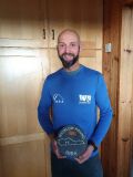
Olga was at the next road crossing where I spent only a couple of minutes, quick refill of Tailwind and on to the next point, through the river at the bottom and up the last big pull towards Prince William Seat. I felt surprisingly strong going up, touched the cairn at the summit and headed for number 26, the last summit of Knocknagun. From the last summit there is the last time of dropping to the road or continuing along the summit but I had never been along that way so I dropped along the long trail down to the road with the last 1.5km slightly uphill to the finish. I couldn’t believe how good I felt considering what I had been through and decided that I should finish this thing as if it was a race so I pushed to run the last km, I could see Olga’s head-torch up ahead and ran for it, covering the last km in well under 6 minutes to finish in exactly 21 hours and 50 minutes, 116 kms with around 6000M of ascent, delighted!!
Doing the Wicklow Round was nowhere near the longest distance run I have done, a few 100 milers and the Kerry Way 200km look like so much more on paper but nothing compares to completing the Wicklow Round, it is undoubtedly my greatest achievement in running due to the combination of navigation, terrain, ascent and distance and it was amazing to be able to share that with Olga, only wish that Andy had been there as he had been such a huge inspiration for this but he was away at the time and I didn’t want to miss the weather window and risk day length shortening much more in the coming weeks.
I consumed over 10 litres of water/Tailwind, 4 bananas, 8 breakfast bars, half a chicken roll, 2 bottles of Lucazade Sport and a cup of chicken soup over the course of the run.
Thanks to everyone who sent messages of support and congratulations and above all to Olga, your boundless support and tolerance make these things what they are x