Mweelrea
Forum Messages
| Author | Date | Message |
|---|---|---|
| Eoin Keith | Feb 16 2011, 12:06pm | A map and profile have been added for the Mweelrea race. Thanks to John McEnri for providing those. |
| Alan Ayling | Feb 16 2011, 2:07pm | I have some memory of the Nephin race being back on this year. Or maybe I dream it or something, don't know. Has the Mweelrea race replaced Nephin? Either way, route looks like some challenge based on the map - bring it on!! |
| Alan Ayling | Feb 16 2011, 2:08pm | Alright, I found the other post which explains it all. D'oh! |
| Colm Hill | Feb 16 2011, 6:43pm | Wont be there due to IOC.. however, I must ask. Free route choice? Or do you have to hit the saddle and stay north of the river? (Looks fun!) |
| Robert Malseed | Mar 27 2011, 1:05pm | I ran up Mweelrea yesterday for an easy jog, and I can only suggest that some markers be laid out on the route, it is quite easy to go off course. I took a tumble due to a well hidden stream and nearing the summit care need to be taken as there is quite a steep cliff. I also advise athletes not to underestimate Mweelrea, even though the boggy terrain will be excellent on the descent the climb up will be tough. |
| John MacEnri | Apr 12 2011, 11:50pm | Hi, responding to Colm Hill's question on route choice for descent. It's a fair question. I hadn't given any thought to that at the time. I was just happy to find out there was a much more accessible route up Mweelrea, that seems to be locally acceptable, and could bring this highest mountain in Connaught into the race calendar. There are 2 parts to your route question. First is whether one must return to the saddle. It's quite risky not to. Although it's hard to see from the map, the gradient would otherwise be a lot steeper. But more importantly, returning to the saddle is the only way in poor visibility of knowing you're dropping off at the correct point. The day I ran it at Christmas the cloud was down, and I did end up relying completely on reaching this local minimum to know for sure where I was. The other part of your query I think relates to whether one could simply follow a very direct line off the southward bend in the stream towards where Scardiff is marked on the OS map and hit the small road that runs North West towards the finish. Clearly there's a good amount to be gained from that. I can't picture clearly enough what the ground is like but my memory is that it would get quite rough. But you'd still gain by it. That being said, the more important factor is that there have been very contentious access problems in that area in the past, and I think that line might very well cross land that is not open to walkers/runners, even if it looks like it presents no physical barrier. So for this route to work in terms of safety, fairness, and not upsetting any local land owners, it would be important for all runners to stick to the route described. As to whether that needs to be policed, or verifiable I don't know. In response to Robert Malseed. I agree that people shouldn't underestimate Mweelrea, but this route certainly does provide the easiest/shortest way up it I've been on. On the point of the cliff, the same could definitely be said of Carrauntoohill, which we actually run much closer to the edge of. People running Mweelrea should have some awareness of their location on the mountain, so from having studied the map and route, they know there's a cliff to the left and safe ground to the right (on the way up that is!). I would also agree with either marshals or markers at the saddle and on the route to the summit from the saddle to ensure people don't get disoriented on the descent. John |
| Zoran Skrba | Apr 28 2011, 10:19pm | is there any mandatory kit for this race? |
| Mick Hanney | Apr 29 2011, 7:51am | I'm assuming: Map, compass, whistle, raincover as mandatory, with hat and gloves optional per RD decision on the morning of the race? |
| Dermot Murphy | Apr 29 2011, 8:45am | Yes, all championship races require the mandatory kit of raincover, map and compass, with other items (hat, gloves, water etc) at discretion of the RD. |
| Dermot Murphy | Apr 29 2011, 9:19am | We could do with some volunteers for this race - a couple for the finish and a few marshals as well. If anyone is available after the Croagh Patrick race, can they please make sure to tell me so that I can see how we are covered. |
| tempted runner | Apr 29 2011, 8:45pm | what is best way to get to start other side of mweelrea from leenane area? are the roads pretty poor or is it obvious where to go? sorry if this insults the intelligence of the more competent navigators. thanks! |
| Mick Hanney | Apr 29 2011, 9:42pm | Not sure why people continue to post questions on the forum by other than their real names? Your OSI map for the area which covers Mweelrea is required for this race. Said map shows a clear route via Louisburgh to race start. Roads get narrowers as you go,but the local map is a must. |
| Paddy Lord | Apr 29 2011, 11:25pm | Dermot. Put me down as a non running volunteer for Mweelrea. See you tomorrow. |
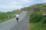
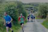
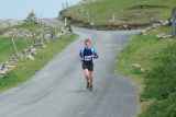
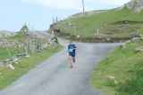
| Mick Hanney | May 1 2011, 6:00pm | Great race. In my opinion the road bit at the start and end could be gotten rid of, so its truly a hill race (fullstop). Great route and brilliant day for it. A very runnable descent and soft and forgiving too. One must wonder though with many IMRA people staying at Delphi if there is not a runnable route which starts and finishes at Delphi? Granted there are safety issues and Mweelrea is rarely as clear as today weatherwise. |
| Zoran Skrba | May 1 2011, 7:09pm | fab two routes, yesterday's croagh Patrick and today's mweelrea. great weather. well done to the winners and Brian who retains the champ title but only by the faster cumulative time over the two races. Robert, Bernard and he had 5 points each after the two races. |
| Dermot Murphy | May 1 2011, 7:31pm | Mick, Turlough has looked at for a route up Mweelrea from the Delphi side a few times and it would be difficult to have a race from that side as it it not safe - especially in wet & cloudy conditions. I dicussed the road bit with Vivian before the race, and from an organisational point of view, it was much easier to have the start and finish at the car park (and that gets preference!!). We had a late arrival for registration today, and if we had decided to run from the bottom of the track, that person would have missed the race or else we would have been delayed another half hour or so. |
| Alan Ayling | May 1 2011, 10:42pm | Dunno about that Dermot... the late arrival could've abandoned his vehicle at the start of the offroad section (and that yoke'd park just about anywhere!) and we could have started the race a full 30 seconds earlier! Kind of agree with Mick about the misery of the road section, but if I were race director I'd definitely want to start and finish at the carpark as we did. Logistically much easier. Thanks to everyone for a superb weekend. Enjoyed just about every minute. |
| Turlough Conway | May 2 2011, 11:57am | Just trying to work out places until results are up: If it was a tie on 5 each then 1 R Malseed 2 B Fortune 3 4 B Furey Who won the ladies?? |
| Mick Hanney | May 2 2011, 6:06pm | Turlough, that 3rd slot could have been yours (after a battle of course). Sadly you missed a brill race :-) |
| John Ahern | May 2 2011, 9:56pm | Just to point out that there seems to be a discrepancy around my result. I definitely came in after Pat Lawless and not 2 places after him as is indicated. Perhaps someone else remembers the running order around those positions. |


