Mullaghcleevaun
Forum Messages
| Author | Date | Message |
|---|---|---|
| Paul Nolan | Feb 13 2011, 1:10pm | Race distance should read 12.1km with 800m climb |
| Barry Moore | Jun 3 2011, 4:39pm | I’m doing a recce Sunday morning if anyone’s interested. I plan to start from Zellars at ~8am, take it nice and easy on the way up and give it a bit of a lash on the way back (my down hill is atrocious). Mail or text me through myIMRA or just turn up at the pub. Paul, if you’re looking for another running volunteer I’d be happy to help. Barry |
| Paul Nolan | Jun 11 2011, 7:48pm | Thanks Barry You can help out with registration. I'm looking for a summit marshal for Black Hill, just to keep people honest... Please remember to bring the usual safety kit to the race. No need for food this time but make sure to have map, compass, whistle, rain jacket, hat and gloves. On the day we'll decide exactly what needs to be carried. Don't forget that registration will close at 11:30 to allow everyone make their way to the start. Parking at/near the start = DNF See you Sunday |
| James Flanagan | Jun 13 2011, 6:36pm | Hi Paul, I can do laptop operator or summit marshal or helper. Just let me know. James |
| Paul Nolan | Jun 13 2011, 7:31pm | Hi James Summit Marshall on Black Hill would be very helpful, the laptop tends to get a rest at the LC races. If you send me an email at b e e c h w o o d ireland com I'll forward you where, when and what details. Thanks, much appreciated, Paul |
| James Flanagan | Jun 13 2011, 8:52pm | Hi Paul, Not having success with your email. My mobile is 087 271 5518. Thanks, James |
| Roman Gregus | Jun 16 2011, 9:29am | Hi Paul (I reckon u r RD) I signed for volunteering for this race, but am still not accepted. Should I do something prior my acceptation? other thing is, I have no mean of transport so would like to carpool there with other volunteers. pls let me know if anyone has free seat. i am openminded to any helping needed, would enjoy marschalling the most, if anyone is not interested I would be, if not, can do anything else necessarry. see you roman - romangregus@yahoo.com 086-2300773 |
| Paul Nolan | Jun 16 2011, 9:54am | Hi Roman Very timely of you, thanks for the offer. I've sent you an email with details. Anyone out there willing to offer this volunteer a lift to the race? |
| Gavan Doherty | Jun 16 2011, 11:36pm | 2 of us took a wander up last Sunday to look at Paul's new Mullaghcleevaun route. It's a super route, but if the mist is down you're not likely to find your way unless you've taken the time in advance to get a map and work out how you'll navigate the route. If the RD's not satisfied you can navigate competently or if you turn up with these notes & no idea how they relate to the map, you're not going to be running. So if you’re thinking about it or wondering how you’d navigate it, here’s a few notes: General notes: =========== If it’s a clear day, you won’t need all the detail below. If the mist is down, you’ll have to rely on your compass, rough idea of distance covered and the shape of the ground (represented by the contours on the map). Summits are distinctive, but tracks aren’t. Snippets of map described below are <a href="http://tinypic.com?ref=2vlsaj8" target="_blank">here</a> (http://i55.tinypic.com/2vlsaj8.jpg). They’ve been taken from the <a href=http://www.eastwestmapping.ie>EastWest</a> map of Wicklow mountains (west), which is available online or from any decent outdoor shop. Highly recommended it’s full of useful detail (eg unsigned parking, access routes), printed on water resistant paper & a good clear scale. Go and buy one. Detailed notes: ============ 1) follow the green/white posts across the Agreed Access Route (little benefit in doing otherwise as the ground is rough on either side of the route). If misty (the posts are up to 150m apart), climb gradually ESE until you reach a green road (literally, it's got grass all over it and will be great on the way back downhill). The Agreed Access Route joins the green road at a gate with green signs on it. 2) from the gate, climb along the green road heading SSE for about 1km. you pass a memorial (skinny stone monument - if it's misty you could miss it), and shortly afterwards the green road deteriorates then peters out 3) at this point there is a faint path marked on the EastWest map (A), but not on Harvey's or OSI. It is there but isn't much more than footprints on boggy grass so if you don't see it, climb steeply ENE up to Black Hill summit (a small pile of stones marks the summit) 4) from the top of Black Hill, the path heading for Mullaghcleevaun isn't obvious unless you're on it. go downhill SE (keep to the right/W of the drain - marked on Harvey's but not on EastWest/OSI) 5) after about 500m descent the ground flattens out as you cross a flat saddle/col between Black Hill & Mullaghcleevaun (B). Climb SE gradually for about 500m (you may see the indistinct path) until you reach a big flat area (C – no contours on the map) 6) cross the flat area heading SSE for about 300m until the ground rises more steeply (D – contours closer together). From here, head SE uphill steeply for about 300m until you reach the broad ridge that runs WNW - ESE up to Mullaghcleevaun (E). (from the flat area there’s an unmarked but distinctive track running roughly SE which is worth taking) 7) the ridge is quite broad so in mist you mightn't know you're on it, but you're likely to see the peat hags marked on the EastWest map (F), but not on the OSI 8) once on this ridge head ESE for about 1km climbing gradually through peat hags 9) after 1km the ground goes from gradual climb to rising steeply (G – contours closer together) and you may see an indistinct path climbing the last 700m to the top of Mullagcleevaun 10) once at the top, take care to follow your compass back if the mist is down. you should aim WNW back the way you came for 700m until the ground flattens out and you're back in the peat hags (G). descend gradually WNW across the peat hags for about 1km then turn NNW aiming for where steeper ground gives way to the big flat area (D). This is the trickiest part to navigate in mist, so you could also play it safe and keep N/right of the broad ridge to get close to the edge of the forest so you know where you are (H - better than going too far S towards Glenbride). 11) once you reach the big flat area retrace your steps as in 4, 5 & 6 above, this time going NW along flat area & saddle (500m) and climb back up Black Hill (500m) 12) at the top of Black Hill the path descending steeply WSW isn't obvious so use your compass. Again if misty and you don't find the path from the top of Black Hill, play it safe and aim N/right of this line so you hit the green road (I - better than going too far S of the track heading for Cornamuck where there's nothing to navigate by) 13) enjoy the descent, turning WNW at the gate to follow the green/white posts back to the finish If it’s a clear day, you can ignore most of the above, but if not it might come in handy! Enjoy. |
| Diarmuid O'Colmain | Jun 17 2011, 10:53am | That is brilliant Gavan. I'm not sure I will have time to recce the route and your notes will help my prep a lot; thanks |
| Zoran Skrba | Jun 19 2011, 8:02pm | Thanks to Paul and Izzy for organising the race, volunteers and summit marshals. Thanks to Dermot for the very nice route. |
| Damian Kelly | Jun 19 2011, 8:16pm | Thanks to Izzy Paul Dermot and the summit marshals for a brillant race. Rgards, Damian kelly |
| Pól Ó Murchú | Jun 19 2011, 10:13pm | Great race today. Really enjoyed it. I'd forotten how good the weekend races are. Thanks to organisers and marshals. Deffo do it again next year. |
| Brendan Lawlor | Jun 20 2011, 9:52am | Great race report from Aidan Roe - the mid pack plodders have their own scribe and O'Cnoic had better watch his back or his quill or something |
| Alan Ayling | Jun 20 2011, 8:26pm | Sorry to have missed this - sounds like a cracker. Went to another event instead, one involving bicycles and mud... wrong call. |
| caitlÃn bent | Jun 20 2011, 9:03pm | Was so looking forward to partaking in this race, but have fallen foul to a bloody bug:( However, there is always next time. Congratulations to all who participated. |
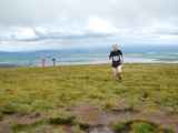
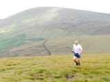
| Roman Gregus | Jun 21 2011, 1:44am | hi all, i have just uploaded pictures i took on black hill when marschalling there on sunday. just little apologize for quality as took friend's SLR nikon for the 1st time and wasnt familiar with it, so many pics finished straight in bin as being blury or overexposed. however hope you will enjoy at least those which were accidentally fine. roman |
| Aidan Blighe | Jun 21 2011, 8:15am | Great race report Aidan. We have had some crackin battles this year, just shows there is plenty of action at the back of the field too. Think we are about even for the season, plenty more to come. |
| John Fitzgerald | Jun 21 2011, 12:43pm | Aiden what a great race report to a fantastic battle down the field.Huge thanks to Paul,Izzy,Dermot and the summit marshals for yet another brillant race.John |


