Mushera-Boggeraghs
- Description:
- Mushera-Boggeraghs
- County:
- Cork
- Date:
- Sunday 3rd March, 2024
- Time:
- 11:00
- Climb (m):
- 500
- Distance (km):
- 10.80
- Event Difficulty:
-
7 (2,3,2) - Moderate Terrain, >500M ascent, 6Km - 10Km
- Race Marking:
-
 -
Route fully marked
-
Route fully marked
- GPS Allowed:
- Yes
- Leagues:
-
Whiskey In The Jar League
- Mandatory Kit:
Level B - Standard
- Waterproof jacket
- Hat or buff
- Gloves
- Whistle
- Charged mobile phone with emergency number stored
- Foil blanket, bivvy bag or equivalent
All runners must bring the above items to the race. The actual kit to be
carried during the race will be finalised on the day, depending on conditions
etc., and clearly advised at Registration.
You should also have the means to carry all the kit in case required.
Failure to have the required items may lead to you being denied entry to the
race, or disqualification. Random checks may be carried out.
- Route Description:
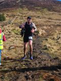
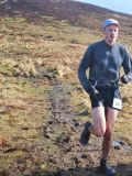
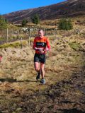
- Open Mountain Race
Mushera Long Route
Route map for Mushera_Long_Route_10km_2024 by IMRA Munster on plotaroute.com
Mushera Short Route
Route map for Mushera_Short_Route_5km_2024 by IMRA Munster on plotaroute.com
10km & 5km
All runners start at the gates of Millstreet Country Park and down the road towards St Johns Well , at approx. (500m) take a right onto the fireroad, where you will start your climb following the Blackwater way (Yellow Man) and IMRA signs ,at (2km) the fireroad will start to disappear, and we're into wet boggy open mountain terrain, at (2.5km) the 5km crew will take a right (signed/marshaled) for their final climb up to the Cairn...on to the Cross and begin the epic descend to the finish line ... While the 10km crew will head on for more open mountain, at (2.8km) you'll meet the 1st of 3 step over the wire, at (3.6km) the yellow man heads off and more IMRA flags appear, at (4km) you will follow the IMRA flags keeping the boundary wire to your left for 1km until you meet your 2nd step over the wire, after this its a (2km) climb to the cairn (highest point) ... follow on the flags for the 3rd and final step over the wire heading for the Cross , at the Cross there's 1km out and back section (extra kudos for anyone who spots the well on the return) back at the Cross again where the fun starts as you start your 1.2km descend to the Finish ..... Flags will mark the safest route down
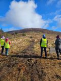
You need to have done 2 non-running volunteer roles in a calendar year to qualify for end of year prize
Check with race director if they have a need for people volunteering and running. Race directors need a minimum number of
people available throughout the race to make the race work so non-running volunteers are preferable. While it can be helpful,
volunteering in a volunteer and race capacity does not count towards qualifying for end of year prize