
Kilmac Running Festival - 5 Tops and 1 Drop
Authors
Lessons Learned in Navigation
08 October, 2023 - Rachel Harney
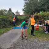
My alarm wakes me at 6am; far too early for an 8am race which is only a 35min drive away. Perhaps I was trying to trick myself into feeling organised - I had not recced the route for today's race!Heading outside to the car, the air was warm and I knew today would be both a physical and mental test. I collected Elizabeth and we headed off to Kilmacanoge GAA. The organisers and helpers were in full swing, with car parking stewards, entry, chip, tag and tracker personnel at work; Even a bbq and refreshments tent was being set up at the start/ finish.
Graham directed us to the local road for the race briefing and start point. I did a quick check of my map and identified the bearing onto the track from the road; 2 minutes later we were off! As we started down the track in single file, someone shouted out "That's the wrong way!", which was followed shortly by one of our group laughing "Stay going!". Little did I know at the time that my mind would be repeating both of these phrases in contest at various stages throughout the day.
It wasn't long until I realised my first mistake. I had happily been trotting along the track in tow of the other runners, without paying a blind bit of attention to my map. Seeing one runner dart to the left early on, I decided he must be one of these heather warriors and kept on my merry way. His choice was the track I had marked on my map. On the first steep ascent I lost sight of the rest of the runners, who were all fitter than me. Ok, time to start looking at the map now. I tried to justify a point on my map where I thought I was, and continued on. As I continued, the sugar lump stayed on my left; 'This is not right...' , and then the realisation of 'I'm hardly on the Sugarloaf Way, am I?'. With no tracks in sight to my left, and having already gone too far, I decided that I should continue on around. Watching two runners descending the Sugarloaf towards me, looking confused as to the direction I was coming from, I turned around to see the car park. 'Right, its going to be straight up the screed and straight down the screed so. Fun times.'
Descending to the car park and onto the Red Lane, I told myself to forget about the mistake. 'You know the route from here to Djouce.' Along Ballyremon Commons, turning left onto Long Hill Road I ran past the dead dear RIP and the dead sofa before entering Djouce Woods at the southern car park. I commenced the long slog up by the Forest edge. I felt slow and lazy, mostly walking, occasionally jogging in the warm air. Finding the stile, I headed up the grass path towards Djouce. No-one was in sight. I set myself a target of 15 minutes to get to Djouce summit. On Djouce, the cooler wind hit me and I felt reinvigorated - I was about to travel to unknown lands (for me); War Hill, Tonduff. No mist, conditions were perfect. The two distinct bearings I had noted (down to the saddle, up to the peak) for both summits came easy to me. The ground did not. Distinctive trails were great but they were slippy. I was glad to be out of ear shot when I let out some groans of protest. From Corrig to Maulin I stayed slightly too far north, but corrected onto the trail heading up to Maulin. 'Excellent - that's the tops, now the drop and then were on the home straight.'
Turning right at the forest edge I knew I had to cross the river before counting my strides to identify the track into the forest. I allowed for contours and found my entry. Again, counting out strides - I needed to be precise here to find the aerial and the top of the Ayling Abyss. The ground was lovely and dry but I decended as carefully as an old lady. Into the woods, I ran along the river. And then I made my second mistake. Starting onto a track to cross the river, something told me to look at my map. Failing to pay attention to the thinner blue line on the map, I decided that I shouldn't cross the river - that the river would start to bend away from me. I ran on. The river did too. I looked at my map again, and corrected my error - heading back to my originally planned crossing point.
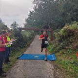
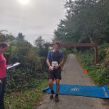
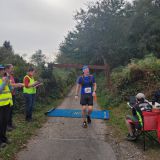
'Now - just to get out of this forest'. I took my bearing and started the climb up the steep hill, crossing tracks and lanes. Nearing the top, I suddenly took a notion to veer right - thinking I heard cars on the road I was looking for (mistake no. 3). I emerged onto a felled area with no road in sight in front of me, but another forest instead. I saw a carpark to my left and the demon in my head convinced me that this must somehow be the Long Hill car park. Cursing myself (and instead of running up to read the sign) I made the decision to run south to try to hit the road further down once I emerged from the forest. After my fruitless little adventure, I turned back and headed up to the car park to find that it was the one I had been searching for all along. Taking a much appreciated handful of jellies from the Marshals, I headed for home - finding my way back nicely around the base of the Great Sugarloaf. With Elizabeth having waited 1hr 50mins for me to finish (my gawd!), we were awarded with 1st and 2nd place females, being the only two entered in the race!
Wow, what a day! Massive thanks to all the patient organisers and helpers, without whom these amazing adventures would never be possible.