Nav Challenge 2
Authors
Nav Challenge 2
28 August, 2017 - Sandra Pegman
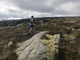
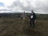
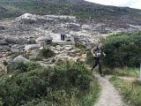
Wow what a wonderful day to be running around the Wicklow mountains - sure what else would you be doing? The weather was glorious and the spirits were high.This was my second ever nav challenge and my aim was to complete the short course and perhaps take a more direct approach to the markers as last week I definitely took the scenic route!! As I'm a beginner, I teamed up with two other people - Tanya and Lorcan - just to be on the safe side. There was a good mixture of terrain with sheep trails, road, tracks and "oh holy jeebes, please don't let me see a spider" cross country terrain. There were only a few incidents of "Sandra, that map is upside down", which is an improvement on last week.
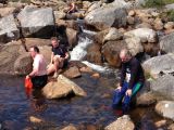
We had to find four particular markers on the day taking in Camaderry, Camaderry East, Turlough Hill and Lough Nahanagan. The views were only spectacular. On finishing the race, there was gorgeous home made banana bread with the usual friendly banter and post race analysis taking place sitting on rocks in the nearby river.
Thank you to Joe and Nora for all the hard work organising the event - what a day!
Crag of Broken Dreams - Long Course Nav 2
28 August, 2017 - James H Cahill
The second of the Navigation Challenges was based at the Miners Village, Glendasan on the Wicklow Gap road.Joe and Nora Lalor were race directing and course marking and my suspicions were plenty of open mountain, across rough ground. Those suspicions were shortly to be confirmed.
Maps were distributed at 10:30 and Joe clarified points on a couple of controls.
The course consisted 7 controls to be visited in any order. Looking at the map there appeared to be a straightforward circuit and the question became whether to travel clockwise or anti-clockwise.
I opted for anti-clockwise and after a short countdown we were off.
Control 7 was located 250 m East of St. Kevin’s way at a shed. The option was whether to run the road and St. Kevins way (longer) or take a roughish looking single track and and some open mountain, or a combination of both!
I opted for the road with a small group of other anti-clockwise runners. The majority of the group took the first path off the road and opted for single track. Others ran a little further and then cut across open mountain This left just Adrian Hennessy and I and we ran the road to the St. Kevins Way junction. I should clarify Adrian ran this section approximately double my pace and I could see him in the distance as I lumbered along behind.
Off at the St. Kevins way junction, and 500 m to an obvious gully and stream. 200 m up the gulley. As I approached the shed a number of runners coming cross country appeared and the road run seemed to be as fast and less energy consuming than the cross country options. First control completed.
The next control was on the St. Kevin’s way stile just short of the Lough Nahangan service road. Two choices - back to St. Kevin’s way or alternately continue up the Gulley for 350m to the Lough Nahangan Service Road and run the road for 1k to the stile
I opted for the former, crossing some rough ground for 300m to rejoin St. Kevin’s way and then on the stile. In retrospect I suspect the second option was quicker as it was better running than St. Kevin’s way.
The next control was located at a stream junction on Tomanenna River. Again there seemed to be two choices, across the two service roads and then head cross country elevating and through the forestry to the stream junction or cross the two service roads continue down the service road to the start of the power lines and climb from there. The first option preserving elevation gained, shorter but with rougher ground. The second option losing elevation, longer but more runnable (at least initially). I opted for the second option. As I ran I could see Mike Long and Paul Smyth to my left and significantly ahead on the open mountain option. Reaching the end of the service road it was cross country and a steep climb by the river. As I climbed both Mike and Paul popped out of the forestry about 50m ahead of me. So the second option was the quicker. The stream junction was marked at approximately 300 m from where I joined the river, however the reality was that the stream junction was significantly further (approx. 500m) so this led to a very slow last 200m as I was convinced I somehow passed the stream junction. Control located and on to the next control
The next control was at a fence bend just before Glanacera Brook. This was a 1km open mountain traverse, and it was simply a case of trying to find the best ground and getting down to the Brook not too far from the fence bend. I chose to make my way South West along the forest line and then South to pick up sight of the fence line to use as a “hand rail” to the fence bend. Louis Mulee reached the fence bend just ahead of me and clearly had found better ground as he had been behind me at the previous control.
The next control was between Lough Firrib and Counavalla on a 10 foot crag. Joe had warned us about the steep crags on a descent from Lough Firrib to Glanacera but I was going up and so how bad could it be. The answer to that is pretty bad, and I encountered some steep dangerous crags and slippy climbing on the way up. Once up my plan was to pick up the single track from Tourlough Hill to Lough Firrib, and follow that to pick up the marked path from Lough Firrib to Counavala. A admirable plan, but very poorly executed. I saw Brian O Meara and Liam Vines coming from an area further West than I expected and in the distance I could see a walker (who surely must have been on the path?). Despite my compass telling me no…...I disregarded my map and compass and went with my gut and towards the walker and a craggy looking spot West of Lough Firrib. Sure enough 500 m later and even further West I came to a crag. The trouble was that this was 500m short of where I expected the crag to be and instead of two crags there was just one. And needless to say and for good measure there was no control. A few minutes of expletives later I had identified the crag I was at on the map and ran the 600m to the correct crag. 15 minutes lost due to not trusting my navigation! I arrived at the crag marvelling at my stupidity,still whinging and talking to myself to find Gavan Doherty hiding behind the crag and photographing my arrival, witnessing and providing documentary evidence of my lunacy!
The next control was at a stream junction on the Glanaslaghbeg river 3.25km from the Crag of Broken Dreams. I planned to descend to the Glanaslagh river track down it for a couple of km and then cross to the Glanaslaghbeg river. When I reached the Glanaslagh river I found the ground between the two rivers to be pretty runnable and so I kept the elevation and ran a mid line to approximately the 500m contour before bearing East to Glanaslaghbeg. I was pretty sure I could see the tributary and river junction but wanted make certain that I didnt end up going to the lower tributary and having to run back up the river and so I bore off more East than South East, hitting the river 200m above the control point and then descending to the control.
One more control to go and it was on the far side of the Camaderry Ridge on a spoil heap on a steep path by Luganure Brook. Having regularly made mistakes on the last control of plenty of navigation events I wanted straightforward navigation and opted to climb to the Camaderry Ridge middway between the Summit and East Top, then run to East top and descend along the path to the control.
Padgraig Doyle appeared at the control just before me having descended from the Camaderry Ridge along a tributary of Luganure Brook. This was the quicker route. Padraig got further away from me on the descent following the miners path down to the miners village and I couldn't make up the ground. Although he briefly gave me hope as he stopped in the Miners Village and seemed to consider running North back to the road and then coming back to the start finish. However, he quickly reorientated himself and went through the Miners Village to the finish line.
I was relatively happy with my route choices. But of course route choice is one thing, executing it is another!
Time could have been saved by:
1. Ascending to the Lough Nahanagan service road to run to control 2 from 7 rather than descending back to St. Kevin’s way
2. Focusing on better ground rather than “handrailing” the fence between controls 1 and 4
3. Believing my map and compass, rather than using a best guess navigation technique between controls 4 and 5. This best guess technique has never worked for me, yet in an illustration of persistent lunacy I still revert to it occasionally!
4. Descending from Camaderry Ridge along the Luganure river rather than ascending Camaderry East top and descending the path.
It was a great day out on a super open mountain course and thank you for Joe and Nora for all the time and effort they put into designing, marking, demarking and running the event on the day.
Nav2 - Above Glendalough - Short course
27 August, 2017 - Mick Hanney
A fine sunny day above Glendalough and a mass of runners have lined up for the 2nd nav challenge courtesy of Joe. Arriving early I had time with others to speculate as to where we might go in the neighbouring hills. Only Joe knew and he wasn't giving anything away until Go time.I'm not quite in Long course fitness at the moment so I opted to do the short. Runners scattered at 10.30 map in hand. Short course was 4 controls best done in a loop, the main decision as to what direction to do them in. I decided to go Clockwise, taking the obvious path up from the miners village while others tooks a more direct option across rougher ground. Quite a few were on the trail and ahead of me I saw last weeks winner Shane Lynch, followed by John Bell. The first control was control 8, at a spoil heap, on the path from the miners.
Towards Turlough hill next, so a direct line on rough ground towards the track which travels up Camaderry. Path attained roughly half-way between the Camaderry summits. Easy running now towards Turlough hill, past 2 mountain bikers pushing their bikes through the boggy trail. Next Control, no. 3, was on the far side. The anti-clockwise route around the lake appeared to be the shorter option. Passed Derek Kellett on this stretch, he taking the early start but travelling in the opposite direction. Derek commented that I had chose the right direction to do it in! In retrospect this was probably true as once the first Control was achieved the rest of the route was downhill on pretty runnable ground.
Control 3 was tucked off a minor trail near Turlough hill. No runners visible from behind but on leaving there, heading directly down towards Wicklow Gap I started to pass other competitors traversing the course in the opposite direction. The question remained as to what direction would prove optimal.
Next Control, no. 2, was on a stile on St. Kevins Way. Easily found after a nice downhill run. To get to the last Control, no. 7, there were a no. of options, chiefly stay on St. Kevins way or backtrack to the service road and traverse around past Lough Nahanagan, which is what I did. Followed the trail at the end and took the right turn into the Gully to find the last Control beside the shed.
All controls done, it was all downhill from here. Decided to avoid the road run which is most of St Kevins way along here and took the minor trail direct down the valley which was water logged in parts and took a few twists and turns across streams. Good fun though. Back onto the trail that we started on and finished in under 74 mins.
Thanks to Joe and Nora for a fine circuit. Thankfully the sun shone and we had great Wicklow vistas to enjoy and mainly dry running. All of which made the nav easy and the compass wasn't needed. Was nice afterwards to cool down and wash off in the stream through the miners village. All IMRA events should be like this.


