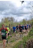
Tomies / Purple Mountain
- Description:
- Killarney Open Mountain race
- County:
- Kerry
- Date:
- Sunday 23rd April, 2023
- Time:
- 11:00
- Climb (m):
- 867
- Distance (km):
- 12.50
- Event Difficulty:
- 9 (3,3,3) - Difficult Terrain, >500M ascent, >10Km
- Race Marking:
-
- Route fully marked
- GPS Allowed:
- No
- Leagues:
- Route Description:
Race route Description.
This race is open to experienced mountain runners with the ability to navigate the route safely with map and compass.
There are multiple steep cliffs which pose a danger of life or limb threatening injury.
Visibility is frequently poor, so please be aware of these hazards before entering.
there is a path for the entire route, however, it is very difficult to follow, due to thick heather, and does not alway present the quickest route. Multiple Cairns do no signify waypoints in this race
A. Commence along twisting gravel/muddy road through old golf course gradually climbing
B. Immediately as you exit Golf Course the path gradient steepens as you enter a cross roads of muddy farm tracks. At this Junction, keep Right of the deer fence taking the narrow, twisting single track path uphill along the Lower Slopes of Tomies. This presents a tight bottleneck that competitors will want to plan for - be out in front or wait behind.
C. Continue along this braided, muddy single track uphill in a southerly direction as you leave the deer fence behind, you are on the open mountain. In good Visibility you can see a steep embankment, to your Right, falling down to the River Loe, and straight ahead, the hulking Dome of the first Tomies Top with its Conical shaped Twin out behind
D. The gradient steepens sharply for a lung bursting climb on grass & heather climb to the top of Tomies spot height 568m
E. Upon reaching this point, gradually descend south, along the path into the saddle for approx 400m before picking up the well defined rocky path climbing steeply up Tomies Mountain immediately South / South East.
F. Once climbing Tomies Mountain competitors may choose their preferred route to the summit shelter on Purple Mountain. This signifies the Race halfway point.
G. Follow back the way you came to race start for a hair razing, leg burning descent Finish. Route will be fully marked Short course also available - 6km to Tomies North Top Spot Height 568m
Route map for Tomies / Purple Mountain Race 2022 by Conor McElroy on plotaroute.com
Driving From Killarney
A. Drive out the N72 (Killorglin Road)
B. Approximately 1km after the Hotel Europe, take the Left turn signed for Carrauntoohil (The Signpost is huge, you can't miss it)
C. Continue along this road for approximately 2.5km passing over the River Laune Bridge.
D. When you meet the Hard Right Turn (@ Tomies Cross) follow the road around to the right.
E. Continue for approximately 300m and take the Left up the Long Driveway (this Left turn will be Signed IMRA Race)
If you find yourself driving past the Hotel Dunloe, you have gone too far.
3. There is limited parking at the race start, please car pool where possible.
Under IMRA rules for competitor's safety, it is MANDATORY to bring and carry a JACKET that is shower and wind proof for the entire race. Highly recommended additional kit: phone with RD's number, survival bag, whistle, map & compass, GPS permitted (we will have OS A4 copies of map available at race registration For short course: rain jacket & phone with RD's number will suffice Any competitor seen not carrying or wearing their jacket at any stage in the race will be disqualified. There are no exceptions to this rule!
Volunteers (Non-Running)
You need to have done 2 non-running volunteer roles in a calendar year to qualify for end of year prize
Volunteers (Running)
Check with race director if they have a need for people volunteering and running. Race directors need a minimum number of people available throughout the race to make the race work so non-running volunteers are preferable. While it can be helpful, volunteering in a volunteer and race capacity does not count towards qualifying for end of year prize


